gaps documentation
This is the documentation for the gaps package in version 2026.195#72d44bb03.
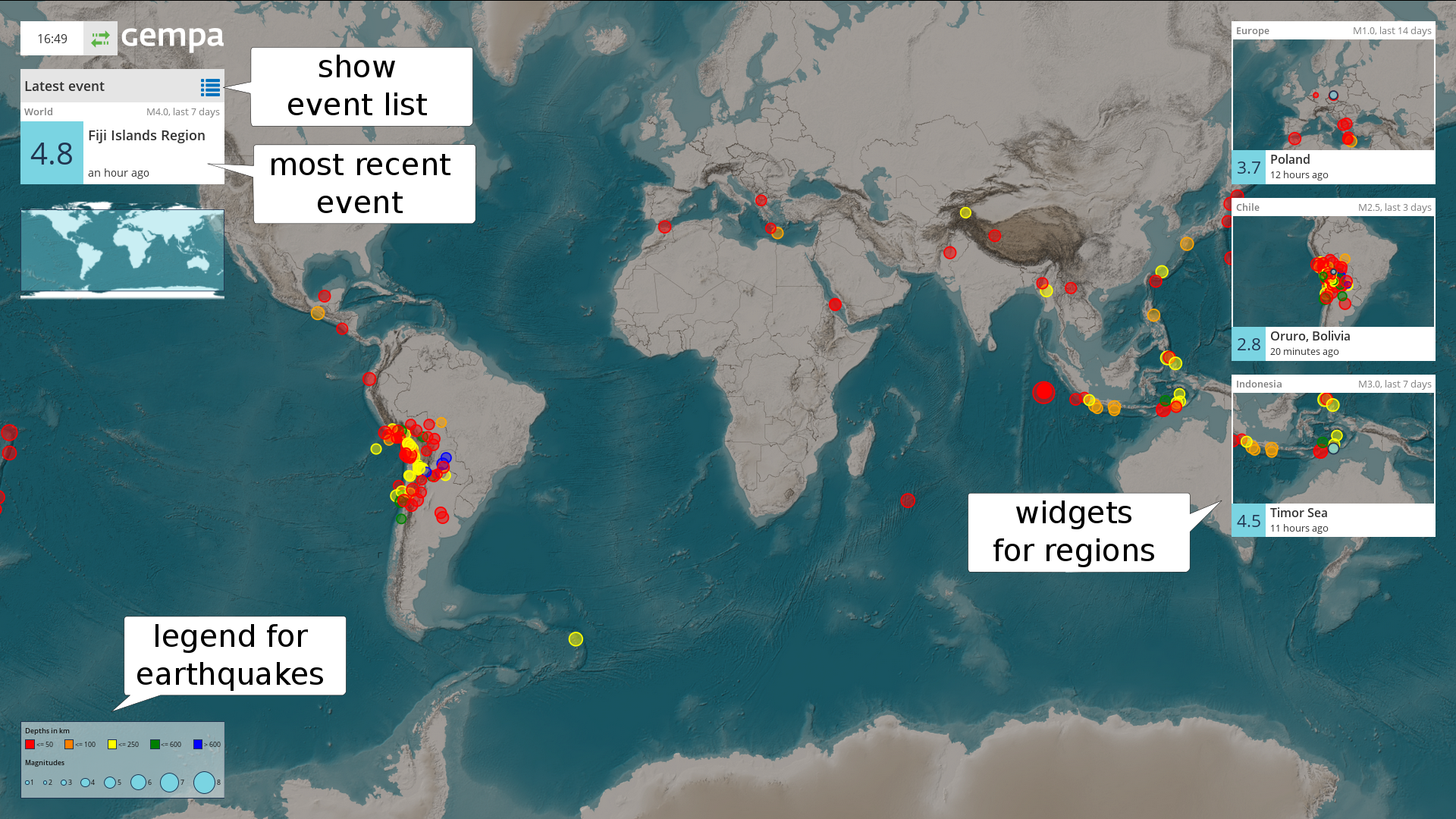
EQView with event widgets and event details
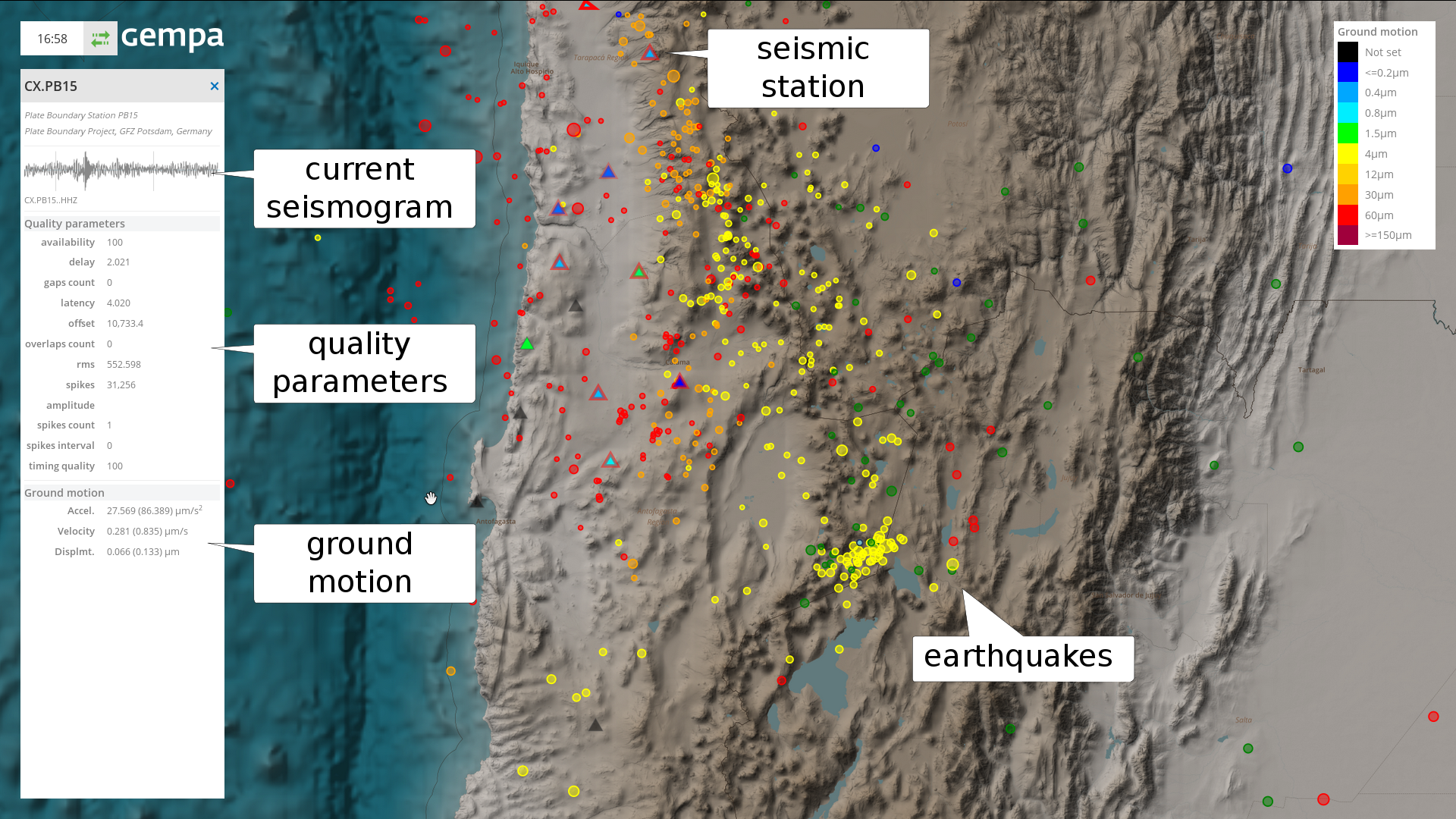
StationView with station and event details
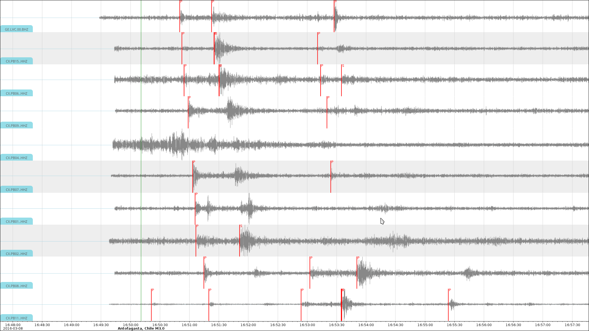
TraceView with interactive filtering and event notifications
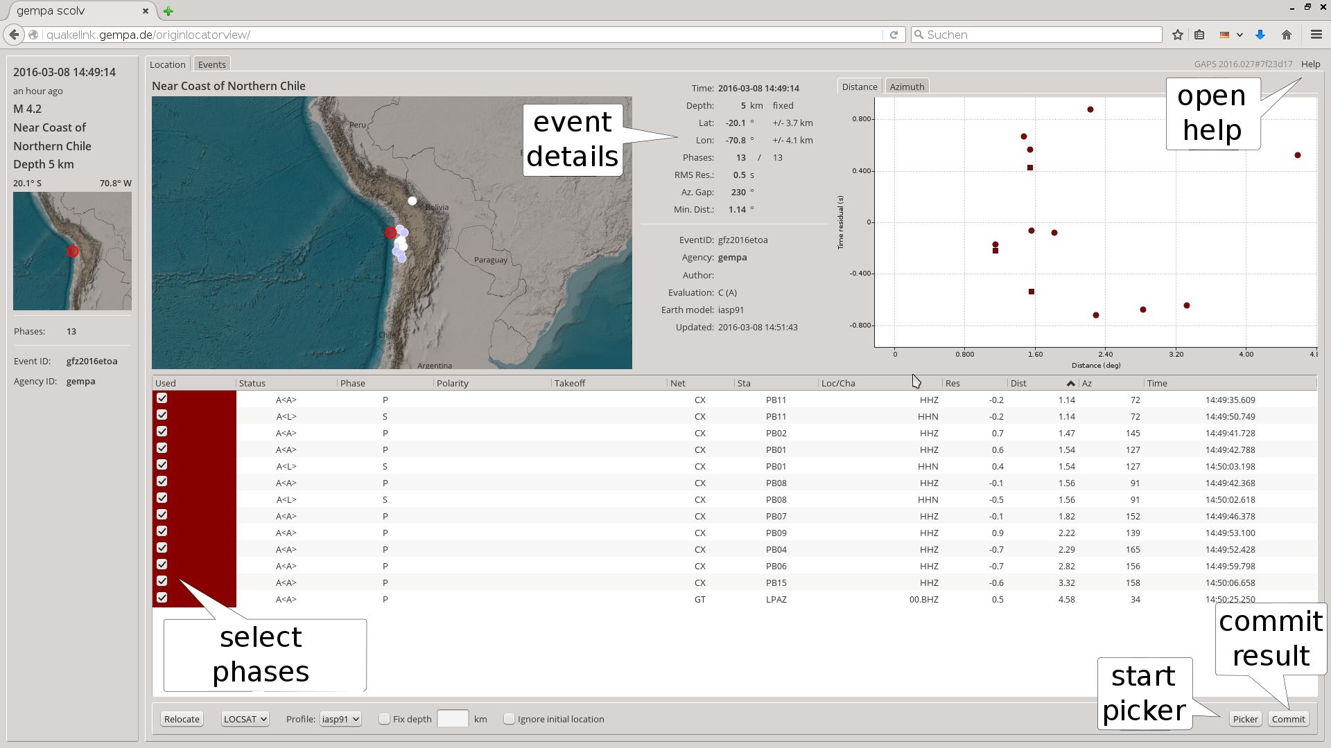
OriginLocatorView for analyzing events in detail